Tuesday, 28 November 2017

Lembongan to Gili Air and across Lombok to Gili Lawang

https://youtu.be/GdhHoGkNDkk

The crossing to Lembongan was uneventful , except for  the amazing current lines we encountered. The difference in a 50m width of the Selat Badung meant a speed of 3 knots or 9knots, all whilst heading in exactly the same direction.

Lembongan, only 12 miles across from Bali, from the anchorage looked ok. We picked up a mooring buoy for the evening and from there we could watch the surfers on two different breaks, and spotted some late afternoon stand up paddlers in the bay to our starboard side. The island seems to be chockers with resorts, and the whole area is supposed to be eco tourism orientated, although how that can be when one of the major thrills and spills is para gliding behind speedboats I'm not sure.
sunset at Lembongan 

Ours was only an overnight stop,but before we departed from which ever day trip boat mooring we had adopted for the evening, I checked out under the hulls in the once again, incredibly clear water. This was the first time, I've been in the water since the close encounter in the middle of the night with the bamboo pole. Both Bali Marina and Serengan were to my mind out of the question for getting in to the briny to take a look.
Damage count, thankfully minimal. Scuffing to the anti foul around the rubber boot of the sail drive and loss of antifoul from rudder blade. Amazing build up of duckweed but no barnacles, and some tiny wee little pippi like growths attaching themselves here and there towards the water line and particularly in the sail drive intakes.

After that we set off northwards to Gili Air. The Gili group sits just on the NW corner off Lombok.

We have worked out a series of potential anchorages, at what we now have deemed is a daily “do able” daylight distance, allowing for ferocious currents and no wind. Each anchorage needs to be made well before sunset, especially if there are fringing reefs to be negotiated. Once having arrived at an anchorage its easy to find ones way out again ,even in the dark if necessary just by following the inbound course in reverse, so I have no objection to early starts, its just late finishes which are to be avoided at all costs.

Having read all about the currents in the Lombok Strait, we set course back to the NW towards the coast of Bali, using the current to our advantage. Just about a third of the way from the top of the island we tacked again and headed across the Lombok Strait, judging that by then the current would be heading North . It runs South far longer and stronger than when it runs North, which it does for about 6 hours a day. The wind had increased substantially by then as well and we had a terrific sail into Gili Air, where we picked up another mooring for the night.
Track around the top of Bali on the way to Bali and track from Bali to Lembongan then back towards Bali before turning for Gili Air


Ashore the place was full of young mainly Europeans, either I guess ,divers or surfers. There isn't really a road, just a wide-ish path capable of allowing pony and traps to travel along. The other mode of transport is bicycle or foot. We had diner at a foreshore establishment ,watching the constant stream of movement as the tourists passed us by, coming or going from the bars and other eating establishments. What was noticeable (comment worthy in fact), was that there were groups of young women, there were couples, but oddly we saw no groups of young men . The information book we had ,says that of the three islands here, Gili Trawangan is the party island, Gili Meno the quiet island ,and Gili Air has a mixture of both, perhaps the young men prefer Gili T?

On the way to Gili Air, we apparently lost a shackle holding the anchor bridle on the port side. The only other shackle on board that would fit, was at Peter's brilliant suggestion, lying idle on the boom, where it should have been attached to the the now useless clew ring of the main. We removed it from the boom and installed it on the bridle and then moused both the port and starboard shackles. Mousing for those who don’t know, is the act of fastening the shackle pin in place with in the good old days of pre plastic, nautical type seizings and wires (depending on the size of the shackle).To be honest , electric cable ties work well, but they do perish, especially in the conditions up here. These shackles pins have been wired in with e a bit of handy fencing wire, I just happen to have packed into my suitcase on one of my return trips to the K'Gari. After all, a girl never knows when a small coil of fencing wire will come in handy!


Leaving Gili Air.
This is  the Eastern side of the island- just a few resorts as you can see.
The following morning we decide to continue on as it was a bit choppy in the bay , precluding a good chance to clean some of that damn duckweed off.


Sailed on to Gili Lawang, nothing to write home about , but an anchorage in a depth of about 8m in black sand. Once the appalling music being played by the local fishermen was turned off , the night was a peaceful one.
The island of Lombok on the way to Gili Lawang 

Anchored at Gili Lawang- comfortable anchorage for the night. 

Bali time

Next morning we went ashore and wandered around Serengan. A once small relatively isolated fishing village , has now been connected by road and bridge to the rest of Bali, much to the distaste of some of the older residents we spoke to.

Balanese street decorations  Serengan
It's still a small village but tourism is here also, with it being a departure point for day tourism to somewhere, also the ubiquitous, when it comes to resorts, para gliding and the more bizarre activity of fast boats towing giant inflatable “flying platforms” .

The villagers still collect seaweed, for eating and cosmetics and this can be seen drying in great spread out piles, along the roadside.

Made enquiries about fuel availability ,and was assured it was “good quality,clean ,best quality Singapore diesel”. Mande could also organise water , laundry etc.

I had made a tentative booking at Bali Marina, which upon enquiry was still available, and as K'Gari was still salt encrusted after the bashing in the Java Sea , we decided to take the option and later in the day shifted to Bali Marina, an hour away.

 The web page  that existed in September ,talked about a world class marina offering , all facilities,wifi, laundry service, fuel,water, restaurant- the standard deal .

Well not exactly. I may be relatively new to this game but …....
Yes its a small marina, 30 boats, booking essential, so I had been surprised that it seemed easy to obtain a berth at relatively short notice.
I think perhaps, it has (had) aspirations of grandeur,but these are yet to be achieved.
The staff, were incredibly helpful,the omelette at breakfast definitely ranking amongst the best I have had, the coffee was good, however some of the reasons for going to a marina, are electricity, (couldn't quite reach the power source from our berth,and the small print does say that if marina is full,please not to use it for air-conditioning as supply might not manage all boats), shore bathroom facilities, yes- but once I saw them, I preferred to shower etc. on board, Wi-Fi, they were “working on it”, laundry, yes but the overnight service took three days, fresh water- yes a winner here, we could actually wash the boat down, and the pressure was good. However had we wanted potable water, that was not available, nor was fuel, unless we had a minimum requirement for 500litres- nope , my max is 400!

We spent the first two days getting ashore via the dinghy as we were head in at a berth which was about 4 feet shorter in length than we were. Another reason for being in a marina is ease of boarding access. Instead we were into the dinghy, hauling ourselves across the 4 foot gap and alighting onto a not particularly stable “finger”.

So next on the agenda, having dismissed fuel, water and electricity as options, was to ask around and see if there was any possibility of getting the clew on the mainsail repaired. A week or so ago, one morning the clew ring webbing had failed and we had been continuing to use the mainsail, by hoisting it only as far as the first reef point, meaning we were about a 1/3rd of the sail area short, but at least we had the option of still using it. Two sail makers names were produced , one with a slightly higher recommendation and conveniently closer than the other. Armed with photos we went to visit to see if the job was possible. The main man wasn't in when we arrived, so phone numbers were exchanged and he would ring us when he returned. Still waiting! I didn't push for it as we appeared to be in the premises of a canvas awning repairer. Removing the mainsail is going to be a major undertaking ,and I wasn't going to do that until there was confirmation that the job could be ,done,competently!
So one task down , next anyone who deals with ICOM HF radios. From ICOM themselves via email from Australia, “no”, however word of mouth came up with a name, a phone call was made , and you guessed it, still waiting for that call, tomorrow, on Bali time!

Ok , so two down one mission to go. Visa extension. Just down the road was the Harbour master ,Immigration and Customs. Armed with all the papers I could think we might need, we went to the Immigration Office. No , wrong one! This was for big ships only. Visa applications need to be done in Denpassar itself. So put that of until the next day.

We were the next day just heading off to Immigration, when I mentioned to a chap on another yacht that we were going if he wanted to come with us. Literally just before we departed we were given information that a visa renewal in Bali could take up to 7 days , requiring fingerprints etc etc. Up to seven days- no thanks, not after Vietnam. I don't like being passport less in a foreign country. Getting the initial visa to get in only took two days, back in Johor Bahru !

Reassessment of option time! We have exactly a month left on the visas. We should be able to cover the distance, seeing what we want to see and make Kupang within the 30 days. From there wind dependent we either exit for Oz or exit Indonesia, enter East Timor, (visa on arrival) ,again wind dependent, to Oz from there or onto the Tambelan Islands (Indonesia again , but re-enter on a one month, visa on arrival) then down to Oz.

What we did actually achieve whilst in the marina, were the major wash down to remove the salt we had collected everywhere, which we did almost as soon as we arrived and an oil change on both engines, and inspection of the salt water impellers- which seemed to occupy an entire day.

Jiggled all the fuel from the gerry cans into the fuel tanks with an a plan to return to Serengan and top up fuel and gerry cans there, so that we leave Bali full of fuel.

A visit to the Benoa Pilot station, which was just up the road, where we talked to the on duty pilot. An interesting pilot station. Three floors up, in what appears to be an otherwise empty building on the waterfront, the front room is occupied by the radio operator, 2 x 12 hour shifts, the back room appeared to be the pilots and from whence the radio operator produced two coffees. 2 pilots on duty out of 4. (Two weeks on /off)

Oh, not forgetting a genius in a small roadside vendors establishment, managed to return our personal hotspots to the phones, which had disappeared when we started using Telkomsel sim cards. Interestingly the Telkomsel salesman hadn't been able to!

Restocked the supplies, at the relatively handy Macro store, including bacon and ham- hooray!
https://youtu.be/b3mvL98vIQE

Shifted back to Serengan and spent a night on the mooring there. In total 300lts of fuel in two hits. 175 into the fuel tanks and gerry cans back ashore to be refilled. When they were returned to us later in the afternoon we departed for Lembongan Island, east of Bali, with the news that Mt Agung the volcano at the northern end of Bali was getting seriously active for the first time in 54 years- locals were in fact being evacuated.
Mt Agung  -looking peaceful on the morning of the 10th August 2017 

The adventure continues along the northern (lee side) of the Indonesian Archipelago, with the next major planned stop ,being Komodo.


Saturday, 18 November 2017

Serengan ,on the island of Bali.

Having spotted the FAD's just on sunset, we decided that perhaps two of us on watch, at least until the moon rose, might just enable us to avoid impaling ourselves on an unwanted floating house.

I do have a night vision scope, which is terrific, especially if there is a bit of moonlight, but the chances of finding these damn things floating around was still going to be minimal. At least by now we had the backscatter of some of the shore lights of Bali, so perhaps we might glimpse something, before we hit it, or, it hits us!

We didn't make a great deal of progress for the first half of the night, which was ok as a low impact speed is better than high. Eventually the fickle wind died and we motored. At least that gave slightly better visibility with the jib now furled, but a faster speed if impact was going to occur.

As luck would have it, we didn’t have any close encounters of the stoppable kind. The couple of FADs we did see, we either altered course to avoid or just watched them pass in the darkness. I have no idea how many passed us unnoticed.

On sunrise the wind came away with vengeance off the land and then died about 0900.
https://youtu.be/bi0jtWgkkz4

We rounded the NE corner of Bali just after 1000, flying at 8kts, 4kts of boat speed and 4 kts of current, having finally ,as if by magic , managed to jag a current that helped , not hindered our progress.

The current  running through the Selat which divides Bali from Lombok is  spectacular in its strength. We were sneaking down the close to the eastern coast  of Bali , and had for the most part of the day got the current with us. Current lines as I have never seen before, clearly going in different directions within a 10-20m width. We actually became quite good at crossing and chasing the current line we were after.

The wind was also an interesting phenomena here. Blowing strongly from one direction and for no apparent reason , suddenly a boat length later it is totally calm and then 60- 180 degree different to what it was moments ago!

At 1520 we arrived at Serengan harbour, about 5miles just north of Benoa harbour (Bali's main port).
Made it between the reefs and even found the buoys


To enter you just find the channel between the reefs which are either side  of the entrance. There are buoys, but a little difficult to locate when coming in late in the afternoon against the sun. However we had the multitude of returning day trip boats to watch , who gave us fairly big clue as to where exactly the entrance was.

Cruised up through the incredibly 'full' moorings, trying to figure out how you contact someone about picking up a mooring. No need to worry, we were approached and offered one by Mande.

We followed him to the mooring buoy and finally after 15 days, we knew we were able to stay as long as we now desired.

Friday, 17 November 2017

Finally a glimpse of Java

Luckily we anchored when we did.

The bridge at Surabaya.we anchored this side of it.


Passing under the bridge the next morning revealed an array of fishing nets, stretched across the bay, including what could tentatively be construed as “the channel”.At any rate we had laid our courses through the deeper gutters and these were festooned with substantial net arrangements.


Having passed under the bridge this is what we encountered. Well actually, several of these- right across the 'channel'

Masses of smoke, really precluded seeing much of the coast

Picking our way through in daylight was easy .It would have been the thing of nightmares in the dark!

We were aiming for an anchorage in what appeared to be the only possible location for the evening and spent the day sailing through a naval practise mine field and firing range.

The mine field didn't appear to be in use!

Practise mine  or buoy for fishermen?
Hour after hour we passed, what I believe were the huge buoys that the fisherman use. Constructed mainly of polystyrene boxes, lashed together and over netted, and bizarrely painted mainly green- perhaps fish can't see green, I don’t know. Peter reckons they were “practise mines”, but I have seen similar creations in Thailand, so I'm going with the fisherman theory. 

The possible anchorage turned out to be a tiny bit exposed in the end, and as we had really been planning on stopping to do a bit of fuel jiggling, we decided if we couldn't , we wouldn't.
We had previously planned to do it in Surabaya Harbour, but the wind against tide, even first thing in the morning had made that an untenable proposition.

We actually did sight Java the next morning, 16miles from the NE corner, there was the volcanic mountainous backdrop we hadn't been able to see for most of its 520nm length. The exception being as we had passed through Surabaya..

That there is a volcano,poking its head through the smoke

Low lying coast line just visible as the  smoke clears


To top it off- wind, and from a direction we could actually use. A rare commodity indeed!

We blasted out into the selat which separates Java from Bali. Decisions decisions, sail on using the wind or head south through the selat and approach Benoa Harbour from the South ,or continue across the North. Calculating that the current would be against us in the selat we chose to go north about .

About 40minutes before dusk we encountered the first of the “mobile homes” or floating cubby houses, aka FAD’s. Hmmmm, maybe we should have gone the other way!


Thursday, 16 November 2017

Surabaya- and a full night of sleep

Following the midnight dip we finally, just after lunch time arrived off the entrance to Surabaya Harbour. The now daily North Easterly had set in and was in full swing against the ebbing 2kts of current coming out of the harbour.   .
https://youtu.be/0M5-zZ9uKSM


We surfed , literally, down the channel across the shallowest part, and past the Pilot station. The breakwater of the pilot station seemed to be comprised of what we decided were possibly the remains of either some failed pilotages or if they have them in Surabaya, exemption runs. Several rusting hulks, left as reminders perhaps! 
Surabaya Pilot Station- liberally decorated with rusting hulks.Not the best advertisment really!

As soon as the surfing ceased and the channel deepened it became calm enough to throw some washing on.

By the time we were in the harbour itself, the cockpit adorned with our washing gave us the appearance of floating laundry, as we picked our way through the anchorage.
laundry vessel manouvering through the anchorage at Surabaya

They can't have much anchor cable out -there simply isn't room


Personally I reckon they could have got a couple of boxes of matches on there as well!

    I’m guessing its Raferty's rules when it comes to anchoring ,and try as we might we could not distinguish any shackle markings on the cables of the ships we passed. If they had more than 3 shackles out in the 10-12m, I would be astounded. There simply was not the room for them to have had more.
Whoopsie - wreckage in Surabaya- note we are approaching it, Not causing it!

Further up the harbour , beyond the main anchorage , and just before we dusk we saw some more failures, the remains just above the water line in one case and clearly visibly aground in the other.
Hmmm- wasn't  me- honest!

We anchored for the first time in seven nights, just on dark, just west of the very impressive bridge.

Not even the duelling mosques kept us awake for long.

Midnight swimming in the Java Sea

As our anticipated anchorage was a no go due to the weather, we were again faced with sailing on through the night. No big deal, but beginning to get a bit tedious. We are cruising, not completing a record breaking global circumnavigation, however if you can't anchor, it is equally pointless just to float about for the 12 hours of darkness, so onwards, onwards.

A pair of spear f.a.d.s in daylight
As dusk had drawn in, we had noticed that as we were close into the coast at the time, a couple of  the large vertically deployed bamboo 'spear' contraptions, another type of  FAD , we had first encountered north of Penang in Malaysia, were in the vicinity. That being the case , best option was to go further out to sea and hope they were closer to the coast.

Single vertical bamboo poles, sometimes with a palm frond or piece of material at the top ate hard enough to spot in broad daylight, and no chance at night.

Yes dear reader, we found one! Or at least the pole part of one.
I suspect the bit we found- the bamboo pole , had actually been hit by a ship and  thus the pole was detached from “what lies beneath” and was free ranging around the ocean – well until we passed by.

Then it decided to hitch a ride with us.

I’m not sure what the skill base of a bamboo pole covered largely in barnacles really is, but to have managed to position itself as it did, fair and square across the starboard sail drive leg, without any means of manoeuvring itself, is quite a feat and obviously I need to give random poles more respect!

So mission impossible was to remove said bamboo pole from its current resting position. The pole I would estimate was about 10 -12m long and the circumference of the thickest end about 6-7”. it had neatly bent itself in two around the leading edge of the saildrive.

I’m sure I've mentioned it before but a saildrive leg looks just like an outboard motor leg, it is just permanently (she thinks hopefully) attached through the hull to the engine and at the lower end in the water under the hull is the propeller.

First things first. Get rid of the headway. That meant dropping the main and furling the jib.

Then drifting in a swell of about half a meter and a sea state on top of that of about 30cm , we attempted to lasso the out board end of the pole, some 5m away.
As the boat drifted in the swell, occasional the out board end of the pole would swing from aft of us, to abeam of us. The attempt to lasso the end proved fruitless. Meanwhile the end that was across the leg and now stretching towards the port hull as we lolled around ,was just short enough (about 4m of it, was between the hulls) to not quite manage to be destroying the anti foul or gelcoat on the port hull.

This fruitless attempt could have continued for some time but I wanted that thing gone before it could do further damage. The quickest way I could think of to do that was by getting in the water and manhandling it off the sail drive leg.

With no debate, as I knew Peter would disagree, I went and got ready, togs ,face mask and snorkel, knife and torch and slid into the water for a midnight dip in the Java Sea.

My first assessment was, that it didn’t look too bad, and the sail drive  didn't appear to have sustained damage.
I swam back towards the thin, out board end which was trailing at about 45 degrees astern, swam it forward to the saildrive  and started to physically push the damn thing so that it would all end up between the hulls and drift away.

That done, it was back under the water  for an inspection of the damage sustained. Clearly we had lost anti-foul off the rudder blade, where the inboard section had been rubbing and also the leading edge of the actual saildrive leg and the bit of the hull at the point where the leg appears through the hull. This was the very point where the rubber 'boot' which Steve had so painstakingly glued on back in Phuket when we were out of the water was.

He had done such an outstanding job that all was in tact.The rubber still stuck tight ,albeit now sans
anti-foul.

After the pole was gone, a quick dive seemed to indicate ,that no twine rope net,etc. was wrapped around any part of us it shouldn’t have been and  then we tested the propellers, so with me in the water still, and at a sensible distance from whirring turning things, but still close enough to see with the beam of the torch, Peter started the engine and engaged the propeller both ahead and astern. Everything looked ok to me visually. As i was there, we did the port one too, just in case.

Note to self; when engaging in midnight dips in less than calm conditions- remember to tie up ones board-shorts first, the elastic in the waist band could not deal with the surging water as I bobbed around!

Apologies once again at the total lack of foresight in filming the  event– I really should have taken go pro with me, along with torch and the knife!!!!

Once back on board a check of the starboard engine and the top (inboard) end of the saildrive appeared to indicate all was well.

Onwards, onwards, into the night!

Post the event, I did think about the number of sea snakes we had passed during the day. They scare me more than sharks up in this part of the world, mainly as we see them and apart from my baby black tip, sighted in Thailand I haven't seen a shark in 2 and half years up here.
Peter tells me not to worry, as its highly unlikely one would bite me- but highly unlikely isn’t good enough odds for me, especially as they rate amongst the most venomous snakes,  after all what where the odds that it was “likely” I would be taking a midnight in the Java Sea in the first place?

Unforgettable- for all the wrong reasons

What followed was the most forgettable part of the adventure so far.

Seven days and four unrelenting nights of bashing our way south against a north westerly running current and a SE'ly wind, then 5 days/nights making still slow progress east ,against a diminished wind and current.
.

The plan when leaving Bawah had been to use the SW'ly wind (still allegedly blowing in the northern hemisphere until October) to our advantage and arrive on the coast of West Kalimantan (Borneo),having sailed through the Tambelan Islands.

Well that plan lasted until about an hour and half after we departed.


Track from Anambas Islands . The wind precluded us from making the west coast of Kalimantan and pinned us to the coast of Sumatra  instead
Firstly the wind died then it backed to the SE along with some rain- oh well, boat can always do with a washdown! The wind then died again and a SW swell seemed to appear out of nowhere in particular, (well obviously it came from the SW, but why so suddenly?)

Motor/sailed for a few hours and then as the wind increased again from the SE we reefed the mainsail down to the second reef for the night , and ploughed on,slowly .
The 120nm overnight sail became a distant memory quite rapidly. Reduced to 3 kts (over the ground) against the dominating wind and current and being forced ever further in a SW direction, we realised by daybreak that the Tambelans were going to have to get by without us!
The twenty four hour distance was only 102nm or moving at 4.25kts.

From then on really it just continued to deteriorate.The sea state had become quite confused on top of the SW'ly swell. We had slammed a fair bit during the night and this pattern continued for the next few days.
Being pinned to the west side of the Java Sea , was the sailing plan that mother nature had decreed.

The most memorable event the next day, was that we crossed (thumped our way over) the Equator at 0932 (lmt), at longitude 105deg 10.777' E. We had managed a pathetic 97nm /4.04kts for the 24 hours.

During the night, thankfully in one of the periods of lighter conditions, we encountered our first and hopefully only, one of the infamous FAD that are used in SE Asia.

A FAD, is a fish aggregation device,or fish attracting device. They come in a variety of forms, and I will devote an entire photo post to them later.
For now all you need to know is they can quite largish structures , which float around the seas allowing fish to aggregate under and around them , thus making them easy fishing spots in deep water, but unlit hazards, especially when you are in a fibreglass 12.5m pod.
My total beam is 6.9m.
The FAD that we encountered – and apologies here, it never occurred to us to take a photo at the time, what with it being pitch dark and the unexpected contact occurring about 10pm when sailing along at 4 knots, was a bamboo structure in the shape of a St George cross.
A dozen or so 10-12m long bamboo poles (max circumference approx 6-8 inches) lashed together on the x axis and the same on the y axis. Strangely , although I was a sleep at the time, I heard it when it arrived.
Plumb between the hulls had gone the x axis, and athwartships, across the bows was the y axis. Could not have pinned it better if we tried.
So surprised were we, that it took a couple of seconds to figure out what had happened. A torch soon revealed what the issue was, and starting the engines , we went astern, and watched it drift clear, until it disappeared from the beam of the torch. An inspection by torch indicated some missing paint ,but apparently , thankfully nothing worse. Sometimes , moving slowly is beneficial!

Finally anchored off the NW corner of Pulau Bangka at 1300 on the third day after 72.75 hours of unrelenting bouncing around. Trying to keep your balance becomes very wearing in a swell that is a couple of meters in height ,combined with a sea state which is about 90 degrees opposed to the swell. Not to mention 72 hours of broken sleep patterns, as we kept watches.
I know K'Gari is a catamaran, but for the first time since I have had her, we have actually had to stow galley essentials like the coffee and the kettle , so that they were unable to escape their captive state and hurtle around free range!

The protection of Pulau Bangka afforded us two nights sleep
The next two days we progressed, still slowly, down Selat Bangka, (Bangka Strait) at least we were out of the 20 knot SEly winds and were really dealing more with the current! Joy of joys being inside an island in the relative protection and shallowness also meant that we could anchor at night and sleep a full nights sleep!

Clearing the Selat , we managed , as the crow flies 33nm in 5.5hrs as we tacked our way almost pointlessly, tryng to make headway.

Why you might ask were we not motoring? There comes a point where the sea conditions make use of the engine a complete waste of time, not to mention fuel and engine hours. Short sharp steep chop is one of those times , and as that was what we had , there was no point in bothering to try. It was far more comfortable to be tacking , doubling the distance travelled and making little actual headway.
The same can be said for the next few days. Once we cleared the protection of the Selat we made good speed and distance for the first six hours. Then it turned to custard again.

The next 96 hours we, spent beating our way south and east.
Arimbi Oilfield
Located north of Jakarta are oil fields. Having not planned to be anywhere near Java, I hadn't really studied their location. As it happens they were now between us and where we trying to get to.
The first one we passed through was the Arimbi Oilfield.
That took care of 12 hours of my life, but it was to get “better”. Further south and closer to the coast lies the Arjuna oil (and now gas) fields. This section was not so user friendly.
slow progress across the Arjuna Oilfield
Entry strictly verboten!
Not a problem to commercial shipping, but a definite blight to a yacht trying to go east in an ESE'ly wind.

Planning as were now were on a daily basis, looking for viable options, we had had as a last resort thought about Jakarta , but we didn't really want to go there, it just seemed that was where we headed under mother natures influence. The entire strategy now, was to get as 'quickly' as possible into the lee of the islands of the archipelago and hope that the wind would therefore be kinder . The oil fields , were just an added hiccup that we needed to deal with.

Another 24 hours of my life disappeared, beating our way east-ish, along the northern edge of the entry strictly prohibited , Arjuna field, the bonus being the weather actually started to ease!

Finally, just one more bit of the Arimbi oilfield loomed onto the chart and we beat our way past that, now with a vague plan to stop in a port called Semarang. However as the weather improved we decided against that and carried on.

The weather pattern had definitely changed. Instead of constant 15-20kts SE'ly winds, we could discern an actual pattern. From dawn to about 0800, the wind definitely had more of an east component in it , so this was the ideal time to be heading south towards the coast and using the east component to lift us. About 0800 the wind swung more to the south, so we would tack and make better use of that component.Then about 1100 it just disappear altogether , leaving us wallowing until we started to motor. Then in the afternoon it was back again from the south.....except the night we decided to stop and anchor in what appeared to be a spot which would be relatively protected from the south , only to find that the afternoon “breeze” was in fact onshore from the NE at about 20-25knots!

So once again we sailed on. 
Bangka to Surabaya track

Monday, 13 November 2017

Palau Bawah- beautiful

Leaving Palau Akar in no wind , we then started to see a front building to the west.Four hours later the sky was leaden tending to black and which arrived with 30 knots and lashing rain as we neared Palau Arabu, which we decided we would not bother stopping at due to the thoroughly inclement weather which was now upon us , as we would have been on a lee shore.

On to Bawah Island. Made good time with the front until it swung a little more on the nose and we ended up beating the last couple of miles to Bawah, which also meant a later than originally intended eta.
The entrance is impossible to spot, but with some GPS co-ordinates supplied by the Howarths, it was easy to nail.
Too late really in the afternoon to be making an approach acros a reef, we would never have attempted it without the co-ordinates.
Once inside the lagoon, it was beautiful- stunning in fact, just like the picture postcards.

The  lookout above the resort

Northern end of the island 
Couldn't resist
Bawah is now a privately resort, the island and lagoon being leased from the government. It is beautiful created and eco green sustainability was very much in mind whenit was built, over a five year period, apparently using no heavy machinary.
The catch is of course , and there always is a catch, you can no longer anchor in the lagoon, and mooring buoys are provided......at a price tag to rival 5 star hotels. However, the time of day being as it was, the fact that there was no where else to go, meant we stayed.

The resort was happy for us to go ashore and dine, ( very reasonably priced, equivalent to Australian prices and fantastic) .

Next day we went ashore again for breakfast, and then a walk to the northeren end of the island and then found our way to the view we were looking for. Stunning! I think I have used that before , but it was beautiful.
Just stunning 

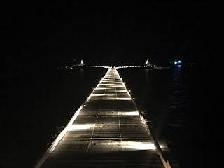
Jetty by day


and by night
Google Bawha resort, if you are interested. I doubt you will find it listed on Agoda or last minute.com!


We left just after lunch and set sail into a promising breeze from the SW, just what the doctor ordered.....until it died!

The Cumi fishermen of Mandriau Bay


After Terempa and obtaining what I hope will turn out to be the correctly issued paperwork, as there does seem to be a certain amount of latitude in the interpretation of what exactly is required, and exactly how many precisely placed and countersigned stamps are needed, depending on perhaps the rise and fall of the temperature or the barometer or perhaps the disinclination to have ones not extremely busy day interrupted, we moved on to a beautifully quiet anchorage in a bay a little to the north of Terempa.

As this anchorage was actually located nearer to the airport ,we sailed through an internet signal zone, after we left the next morning. I think much to the surprise of the local fisherman we then floated about “in the zone” randomly it would appear, whilst “in the signal”, allowing for communication with the outside world and the payment of some bills via the wonder of internet banking, as apparently, life in the real world is continuing to grind away, needing the odd bit of attention to keep the wheels of commerce turning.

We eventually anchored again in a beautiful inlet at an island called Mandriau. In the bay as we arrived were 10-12 floating houses, or so it appeared. Upon closer inspection they were squid (cumi) fisherman.
There were signs of life on a couple of them and then about two hours before dusk, 3 small boats appeared with the fisherman, from where we are still not sure,as there were no nearby villages. They came by to check us out and then the boats did the rounds dropping fisherman off to the various squid boats.


As we watched, the “village” set off to sea for the nights fishing.

Out they go 

Each platform is towed out of the bay by a boat. The boat then returned and towed another and another until the bay was empty, save us and one squid boat.
Some of the squid boats had been rafted up together, and each one was towed separately.

The neighbourhood lights up
As it got darker ,astern of us, the sea was a blaze of lights.  They obviously have generators for the lights, but not for powering up an anchor winch. The anchors are retrieved manually, using a two poled vertical capstan arrangement.
Some of them as they passed us, appeared to have a pole running forward and aft down each side with nets attached. Perhaps here they catch
the squid in nets rather than the jigger system we have seen else where.

The next morning they returned , an exact reversal of procedure. Watching them raft 6 up together was fascinating. Seamlessly dropping one alongside the last, using only a longish tow line behind a single boat, passing so close to the '”raft “ that lines are just passed across, and q.e.d. the task is completed, once an anchor is dropped , from what had been the towing line. In no time the bay was basically deserted again of fisherman, as they returned from whence they came.

Before they left with their nights catch , we went over to buy some squid. $3 procured us a bag full, which provided at least three meals worth. We stopped them from giving us more, as they just looked as though they were going to fill the bag we had given them. Three double handfuls were more than enough for us!

After that whilst the washing dried, we ventured ashore to give the drone a bit of a test flight. Drone had a near death experience back at Ayam anchorage, when taking off from the fore deck.
I have flown it very few times and until now always with vision , provided via mobile phone app. No signal means no app , so flying it is only by visually watching the drone.
During take off, I was a tad hesitant and didn’t get the altitude high enough as quickly as I should. I’m not sure if there was a slight updraught through the trampoline , or if we swung slightly on the anchor , or if I was just too slow, or a combination of all or some of the above but I realised (in slow motion really) that it was not going to clear the safety wires. Indeed as I lunged towards it to grab it from underneath the blade did just tip the upper wire,resulting in a tiny nick in a set of blades.

Mandriau Bay .The  cumi fisherman  have returned for the day

My flight control ineptitude almost resulted in the early demise into a watery grave of drone. Since then , I had been waiting for an opportunity for a test flight on Terra Firma The beach at the head of the bay presented such an opportunity.

Result , yes all ok, drone flies fine. The footage seems a little jerky but that will be nothing to do with the near death experience , that is just trying to preset the aperture and light settings prior to take off, as I have no way of seeing what is being recorded without the app. Sort of like flying on IFR, I guess! 

We moved on to Akar Island , yet another beautiful anchorage in a bay. Talk about seclusion, apart from the squid fisherman in Mandriau, every anchorage has been ours alone.

Lost my little spoon spinner on the way- something must have hit and run.we didn't notice as a the time we were having a great sail in about 15 knots of wind. I think that takes the lost lure total to two now.

We started to clean the squid,but decided to do the lot and freeze them down in meal size portions.

We dined on cumi, marinated for a short time in a little oil, soy ,ginger and sweet chili and a little squeeze of juice our ever depleting lime stock, then flash fried on the bbq- tender and yummy!

Akar Island- wonder if we will find an anchorage amongst the crowd?


Sunday, 12 November 2017

Terempa


The capital.
We did the rounds of Harbour Master ,Customs and Quarantine. Very confusing!
When we had checked in to Indonesia at Nongsa Point I had been asked what my next port was?
Mistake number , Ive lost count, in this learning experience of cruising.

What I should have said ,was the most distant port in Indonesia that I could possibly have thought of.
I however ,had said the Anambas, which was literally my next port. So I had been issued with a port clearance to the Anambas. Now I had to convince them in the Anambas that looking at my papers and them saying “no need”, when I asked for a stamp and clearance, was possibly not going to cut the mustard in 1600miles when I tried to check out of Indonesia.

Proof of having been there?? Hope so
I'm even dressed in my 'officialdom'  visiting gear.


Round one went to the Harbour Masters office, who was adamant that I needed nothing. So to prove we had been there in lieu of an official stamp, a photo outside the office. 
Next it was off to customs, who photocopied the papers I proffered and assured me that I had no need to see Customs again until my last port in Indonesia when I check out.
A Customs officer then wandered with us down the street to Quarantine , who also seemed puzzled by my quest for a stamp, or anything to officially prove I had been to visit them in the Anambas.

After our departure from Malaysia, I was feeling a tad uncomfortable with the non application of any official stamp to any of my paperwork.

Although we had obtained sim cards in Nongsa, it appeared that email technology etc was still yet to arrive in the Anambas via Telkomsel.

I had engaged an agent to provide me with both the sponsor letter to enable the issue of the original visa and in case we needed any “local” assistance for the duration.
Via texts we commuiated and I expressed my concern at the lack of interest by officialdom. I was advised to return in the morning to the Harbour Master and insist on a port clearance being issued.

This I did, and having asked for it, it was eventually provided, just as soon as the “officer in charge of issuing such things” was summoned. He arrived eventually and then from there, with a completed set of papers, as luckily Im getting a bit more savvy about these things, and I had photograped, using the marvels of technology and mobile phones ,all 6 pages which I had handed over, and was able to show them the missing page which had not returned to me,and which was eventually located on the desk he had been typing at. Then clutching a new clearance to the farthest port I could name in Eastern Indonesia, it was back to Quarantine, who obligingly now issued me with a new Quarantine clearance.

 K'Gari anchored 40m off the wall
Terempa itself, the town of , was a busy port. We anchored in the SE corner of the bay about 40 m off the wall that turned out to be a thoroughfare, full of motorbikes and mini trucks, not much bigger than golf buggies, in about 12m on a sandy bottom.
The shipping was small coastal stuff and fishing boats, but it was fairly constant and fun to watch the manouvres, no tugs and manual anchor recovering!


The town

The main wharves
Just so we know we are!


The people were so friendly, a young woman on a motor scooter , stopped as we wandered down the main street and asked if we would like to come to her house and have a meal. A chap on a bicycle stopped to say hello, shake hands and welcome us to his home town. The kids were great- they can all say hello- as its exactly that in Indonesian apparently, then they just started laughing and giggling to themselves and following us. Two separate young lads on bicycles stopped to ask where we from and practise their English. The people could not have been more friendly or welcoming.

https://youtu.be/_DcWgteOURE

The morning that I was to spend pursuing officialdom for a clearance, we were about to set off , when we decided to stay onboard as there was an obvious front moving towards us. As it hit, we started the engines to ensure that we didn't drag the anchor as we only had 40 meters between us and the wall at the end of the harbour. We stayed put!
 Then it was back ashore via the somewhat dodgy wooden ladder which came down from the breakwater onto the floating pontoon we were tying the dinghy up to. We did notice that literally overnight, where the ladder was leaning on the concrete wall. the side bar of the ladder had worn away by at least half its width. The rungs of the ladder appeared to be made from boards from an old orange box and not entirely afixed to the side arms in a couple of places.
With years of training of assessing dodgy ladders, we decided it would suffice, just- especially as there was no alternative!

Banks were available and small shops selling hardware, small groceries, a bakery, a couple of places to eat , a coffee shop, the mosque seemed to make up the main street. The fish market was located neaer to the wharves and we did wander past a laundry. No apparently obvious larger stores.

Terempa Harbour


A tiny Indonesian town , 150 miles east off the main coast of the the Malaysian Peninsula, and 150miles NE of Batam which is the first part of Indonesia opposite Singapore, and a delightful place to visit.