Friday 18 May 2018

Gladstone

My aim had been to transit down to Gladstone via the Narrows.
This is the waterway which dries at low tide- almost Secret Water stuff, for those familiar with my favourite childhood series of books by Arthur Ransome ,which passes between Curtis Island and the mainland.

On the north west end of the island is Sea Hill Light, and it is from here that ships enter for the port of Port Alma. Beyond Port Alma, the now, defunct for commercial shipping,  port of Rockhampton lies further up the Fitzroy River.

Cape Capricorn
On the NE side lies Cape Capricorn, a light once manned, as recently as the early eighties by light house keepers.I know, as it is one of the many that I went to when on board the Cape Moreton, servicing and resupplying the lights and the lighthouse keepers and their families.
Cape Capricorn light  lies on the Tropic of Capricorn.


Soon K'Gari would be leaving the tropics.

The tide was right for a transit through the narrows in daylight, and that was my plan.

On the day in question, the wind however started to back around and so instead of motoring down through the narrows, we decided to sail down the eastern side of Curtis Island.

K'Gari was unstoppable once she rounded Cape Capricorn.
Flying towards Gladstone- who ever would have thought it?

We entered  the harbour via the East channel, after dark. Having never been in or out of the North Channel, between Curtis and Facing Island ,now was not the time to try, in the dark and at low water.
Instead we took  the old tried and tested route and then anchored off Manning Reef until the morning when we could shift across to the marina, where the plan was to sit out the next 5 or so days of   SE'ly winds which was the forecast. Hardly a trial from my point of view as Gladstone was my place of employment for the last 12 years , so plenty of friends to catch up with.

Wednesday 16 May 2018

Keppel Islands

A night at Pearl Bay, well half a night, as we didn't tuck right inside, an early start at 0200,when the wind swung and the anchorage became choppy- well if you awake you may as well go somewhere.....

Dropped the sails again about 0400 as the small amount of  wind , was right astern and the main was flogging. As soon as it was sunrise, I was eager to get the mighty pretty sail out again, much to Jo's disdain- she doesn't find it relaxing at all when the MPS is up. Apparently  I make her tense, something about not wrapping it around the cross trees! To help her get over this 'fear', the breeze was perfect so we sailed, without incident,from 0600 -1400 with the MPS. Yee ha! The longest run so far with the MPS.

Cape Manifold  in the distance in the early morning sun


Arrived at Great Keppel Island- one look at the 'crowds' anchored off the main beach and we hightailed it round to Long Beach, which was much more to our taste with only half a dozen others , well spread out, in the available anchorages in the bay.
Long Bay anchorage in the evening

Middle Percy Island

Motoring on a windless morning through the Hay Point anchorages enroute to Middle Percy Island
Next destination, Middle Percy Island and home of the Percy Island Yacht Club.

It's a must stop for every cruising yacht  in Queensland waters. The names on the plaques displayed at the Percy Hilton, atWest Bay record the history and creativness of generations of passing yachts and their crews.


Proof positive 6.1kts in bugger all breeze


We had a good sail once the afternoon zephyr kicked in- even managing to get up that M(ighty) P(retty) S(ail), as one of Jo's friends refers to it .
The MPS  had to go up, as the friends I met in Cairns, Bill and Frances, tsked tsked my theory that the wind would swing enough to get it out and flying! Hence the photo opportunity- not to mention the 6kts it produced  in bugger all breeze!

Yes that is Percy Island off the port bow


PIYC  'totem'

The Percy Hilton- early morning


I will have to return and find a space for K'Gari to exist at the Percy Hilton amongst all the others.

Haul out number three.

Went across to the yard first thing in the morning to see what was what, and talk to the very affable Greg at Mackay Shipyard and of course sign my life away with regard to the lift which was to take place.

Mine would be the last lift of the day, so we waited until getting the call to shift over to the hoist at 1315.

Out she came, beautifully and I had arranged to be left hanging in the sling and go back in the water first lift in the morning all being well, and if not, if I had encountered any problems be shifted further into the yard.

Apart from the usual stumbling block of not having the right strength, or perhaps more to the point correct tool for the job, it went well.

as usual sitting down on the job!
The antifoul is holding up fine. 36 barnacles in total after 11 months and most of them were in the difficult to antifoul spot on the top of the rudder blades, the rubber boots and  the very bottom of the keels, which got antifouled last, just before the refloat in Thailand.

As for the right tool, I managed the port saildrive oil change just fine, but struggled to undo the plug on the starboard side. A quick visit to the lovely Yanmar people in the yard and I returned with a borrowed impact screwdriver. Q.E.D! I now have purchased  my own, for future use.
Oil change and anodes change and all was done before dark- just as well as it bucketed down about 7pm.

Hanging about on the descent
Back in the water first thing in the morning, at low water and yes it looked a long way down to the water!
Everything checked out as ok when I restarted the engines, so it was over to the fuel berth, to refuel.
We had to wait for the fuel berth to open at 0830 and then having finished that needed to wash the boat as it was without doubt the dirtiest  diesel hose  so far, and despite being incredibly careful, anywhere it had touched needed a soogee to clean off the diesel.
safe'n' sound back in the water

By the time that was done, we departed at 1050, ostensibly heading south. That idea was quickly changed to returning to St Bees for the night, as the speed we were making wasn't going to get us anywhere handy to anchor for the night if we carried on to the south.

Anchored for the night in the now almost empty Homestead Bay at St Bees. Interestingly in the intervening three days since we were last here, someone had unfortunately come a cropper in the NE corner of the bay. A couple of masts at a "rakish" angle on a monohull were clearly visible, but not much else. I guess the proximity of the reef to the anchorages was as bad as we had thought. Some body's dream had come to a watery end.

Monday 7 May 2018

Has the coral spawned?

From Keswick to Mackay is only a 15 mile run and I planned to use the morning flooding tide to run down from Keswick Island. Another brilliant idea, as there was absolutely no wind.
The surface of the water gave every impression that the coral may have indeed spawned, even though the full moon was in fact this very night.
https://youtu.be/4wfpn7R7Rtw
Aced it into my allotted berth, the tightest manoeuvre yet, and of course not a single observer to note the effortless (apparently) berthing. It is a well acknowledged truism, that it  will only be  when the manoeuvre is turning to custard  (quicker than it sets in a microwave)  that there is an audience on hand- NEVER when its perfect!! 
Spent the rest of the afternoon sorting out the anodes and saildrive oil, tools and things needed for the haul out tomorrow.
Enjoyed a delightfully tender steak at the old yacht club.

First rubbish run since Cairns producing the  evidence  of our totally balanced diet for the last fortnight, and I wont put my hand for either the coke or the milk!
 

Whitsunday wanderings and my first manta ray encounter.

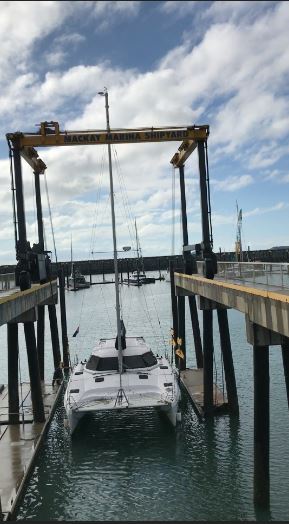
We set off for no particular destination in the Whitsundays, my only timetable commitment being in five days time, for a haulout at Mackay.

The SE'ly was  by now decreasing and would allow an easy passage across to Hook Island, so that was as good a plan as any. The wind faded  away to a glassy nothing, and we motored the last couple of miles and picked up a mooring in South Stonehaven Bay. Water was again  less than clear, but at LW, having watched boat after boat of snorkellers splashing about at the southern end of the bay, we ventured in for a snorkel, as most of the boats had by now  departed. We drifted down towing the dinghy and sure enough there was some respectable coral and even a giant clam or two.
Note to self- it turns out Optus reception was precisely one mooring further to seaward from the one we had selected!

Over the next few days we meandered from Stonehaven to St Bees Island,firstly  sailing down through Cid Harbour, noting the MV Banks, a fishing vessel from Ulladulla which went ashore during Cyclone Debbie in May 17, was till there - high and dry on Daniel Point.
MV Banks 
 Passing out  through Hunt Channel under sail, we encountered 3 motor vessels,2 of  which easily met the criteria to be pronounced as Hullabaloos. The term comes from my favourite childrens book series- Swallows and Amazons by Arthur Ransome . The  "Hullabaloos" are  a party of noisy holidaymakers on the river who are damaging the riverbanks and wildlife.
Although we were not on a river, these ghastly power cruisers slow down for no one, ignore the simple rules of the road, about who gives way to who and don't give a damn about the wake they cause, as they for some reason (known only to themselves) must at all costs , including deviating from their course, cross ahead of a yacht under sail. Guess it just shows, you don't need manners or brains to own a stink boat.

https://youtu.be/YDTMSK7YAFE
For the first time in my life since the resort was opened  on it,  I ventured within a stones throw of  Hamo, as it seems to be universally referred to by boaties. Not sure I have missed anything and we certainly didn't stop there. Opposite Hamilton Island is Dent Island- somewhere I have been, when replenishing the lighthouse which stands on its western side. Dent Island leased under the same arrangement as Hamilton, is now the golf course for Hamilton Island.


A lovely and for the first time in days , solo anchorage , was found at the northern end of Lindeman Island , when we anchored off Boat Port beach . Going ashore in the late afternoon for a spot of exploration, revealed a campsite is available here, b.y.o everything. There were masses of shells piled up on the NW tip of Lindeman- to us it didn't look as though anybody has been here for many months, perhaps since TC Debbie last year? Overwhelming and very obviously, it occurred to both of us, that here ankle deep in shells, the thing that was missing that has been so constant over the last two and a bit years was the complete absence of several feet of plastic detritus. Not a single plastic drink bottle, fishing buoy, piece of footware, nothing but driftwood and shells!
All alone off  Boat Port beach Lindeman Island 

Another anchorage which we tried was Brampton Island- yet another now closed resort, can be found on the North side of the island. This southern  end of the Whitsundays is far less crowded than the islands to the north when it comes to finding anchorages and solitude.

Well that was solitude until we arrived at  the pair of islands, Keswick and St Bees. The wind now being from the north, the southern ends of the islands were the go. We sailed there comfortably until in the lee of Keswick and the wind died, then  it appeared as though we had arrived into a major traffic system, monohulls motoring past at full tilt, towards Homestead Bay.
For obvious reasons as it turned out, as the anchorage is relatively limited really. On our way we checked out the bays on Keswick, which had a small swell rolling into them despite the now northerly wind. Continuing on to Homestead Bay, we decided it was way to crowded for us and went to inspect the next bay to the north in Egremont Pass, which seemed bereft of boats, despite having an apparently similar look to it on the charts, depth wise and on the google earth (GE) photo we had available. Current flow was the issue, as well as a rather sudden rise from 10m to 2m depth over potentially crunchy stuff, so we left the bay to itself and after one drop of the anchor in another bay to the south which resulted in grinding noises , which had me heaving the anchor home , before the weight even came on to it, we elected to go back to one of the bays on Keswick.
The swell stopped rolling around the point as soon as the tide stopped ebbing and it was a very pleasant anchorage which we shared with only one other catamaran, who was anchored in the diametrically opposed corner to us.
Went for a snorkel at about 1600 which was LW, but water was relatively murky, with visibility  when once in the water, of only a couple of meters. I think on neap tides and when the sun is at its zenith, this might be worth another look, as the coral looked ok.

 What didn't look ok, was my first encounter with a manta ray. It loomed out of the murk to my right and as I was still trying to  remember to breathe and as  my brain was now telling me  it was ok as it wasn't a shark, it swept past me. Its 'wing' span, to I imagine what were  my saucerlike eyes, was wider than I am tall.
Enough!
 I have it on my list to swim with manta rays, but I have long envisaged this would be in clear water, so I could clearly see them gliding past, rather like slow motion David Attenborough footage, not a murky sweep past, that left my heart thumping.

Cape Gloucester


Following a very peaceful nights snooze  in Queens Bay, we assessed the options and with the third reef in the mainsail still, used the prevailing wind to shoot across to the Eco Lodge , Cape Gloucester, 11nm away, to sit out the rest of the SE'ly, which was forecast for next couple of days.


 Lost sunglasses pair number two on the way, as they blew clean off  the top of my head in a 26kt gust, as we tacked our way into the anchorage.  We took up a mooring as there were many to chose from and went ashore for lunch.
Gloucester Island

https://youtu.be/ANg2AHmS3gE


The relatively unoccupied anchorage/moorings -unlike in August when it is the final rendezvous for the Shag Islet Cruising Yacht Club
Using the tide the next morning we passed through the Gloucester Passage and Jo anchored us in Jonah Bay. Her first time not being in at the pointy end for a let go. Decisions, decisions! Its always an experience when you take up  a new challenge and try executing a routine job from another perspective, but 'regular crew' need to be able to do many roles  with confidence and the only way to get that confidence, is have a go. First command mission successful, having safely shifted us through the  passage and anchored us again, as it was still too windy to venture further.

The drizzle which arrived as we were anchoring  began to lift and the late afternoon was beautiful. Also managed to have phone reception and confirmed my haul out in Mackay, was still ok.

Wednesday 2 May 2018

Forecast, what forecast?

Shortly after dropping the pick in Horseshoe Bay we had a couple of visitors from another yacht, enquiring about the conditions, which had been lovely for sailing in, and bemoaning the fact that they had been waiting several days and could see no break within the next week.

The Bureau of Meteorology in Oz does an amazing job, and now that I am so much closer to the elements,only a couple of feet above the seasurface , and having spent time in SE Asia with forecasts that are laughable in comparison, I appreciate the Bureau  even more. The radar weather pictures  that are available,  the updated marine forecast,all excellent stuff, and a large percentage of it is absolutely accurate, however it is just that, a forecast.

Needless to say having just read all that, we awoke the next morning and there was no howling SE'ly, so we decided to poke around the corner and see what lay beyond the protection of the bay.
Plan A was to have look, plan B- turn tail and retreat if necessary, plan C , carry on.

We set off  after doing the washing, as the indication was for the wind to swing from the SE to the E or NE in the afternoon.

Nine hours later , having motored for only 3 of those, when the wind died completely before coming in from the East, we dropped the pick in the lee of Cape Bowling Green. Not a huge run (only 41 miles covered , but definitely not in a straight line) as we had gone east on the SE'ly wind and then used the change of wind to the East to make our southerly leg component.

We saw nobody else venturing out and yet  the conditions were in fact, quite pleasant. Sailing along and listening to the  first of the Ashes Test, series. Alas no fish!

Similarly the next morning the forecast was still pretty much the same . SE'ly in the morning swinging  E-NE before becoming  SE'ly again in the early hours of the following morning- by which time, we would ,of course, with my executive planning ability, be tucked up in a nice anchorage inside Upstart Bay!

So we headed East waiting for the wind change.This took us pretty well smack over the site of the SS Yongala -at 109m long, Australia's biggest and still the most intact, historical shipwreck. She was a passenger ship which sank during a cyclone in 1911.
Jo has dived on her, however it's still on my list of things to do, 'one day', when I have time, and that is despite living in FNQ for 11 years and it then being, "just down the road".

After the Easterly arrived, we were having a great sail, so good in fact, that when we intercepted by QWPS (Qld Water Police Service) just NE of Cape Upstart, it was too lumpy for them to board, so they tagged along off the aft quarter , whilst asking their questions, asking to see our flares,EPIRB and lifejackets.
As it was only 1400 it was too early to stop and only a few more hours (at the current speed) to Cape Edgecumbe , so I decided to carry on, we would be there just after 1900hrs at the latest after all, and there we could tuck up and wait for the SEly due in the early hours of the morning to blow through.

Wrong ,wrong ,wrong, oh how wrong that decision was!

Having gone past Cape Upstart , the wind started to die a little by little and by 1800 instead of being almost at Cape Edgecumbe, we were still north of Abbot Point and now being battered by 20-23 knots on the nose (of course) in sea conditions that although not uncomfortable , were certainly not pleasant.Wind versus current made for a very quick build up of a sea sate of a couple of meters. We were reefed right down and just continued to beat our way slowly southwards. Finally arriving in the bay in the lee of Cape Edgecumbe at 0115, after a record making, as opposed to breaking, 7 hours to get past Abbot Point.
Those last four tacks took 7 hours. What a breeze-literally!


Orpheus Island to Magnetic Island

We took up a buoy mooring in Pioneer Bay, and went ashore to -not much really. A sandy bay with coral edges around the foreshore.There is a toilet ashore and it is a designated self sufficient camping site, as it is part of the National Park.
Just around the small headland to the south from the mooring, but still within Pioneer Bay, there is a research station.Part of James Cook University. They are much more welcoming than the resort in the  next big bay to the south about halfway down the Island ,Hazard Bay , at which non paying/staying visitors are persona non grata .
The afternoon we arrived, it was 1530 when we took up the mooring and went ashore, to the nearest beach.We decided the water was too turbid to be inviting and so after a brief explore we returned to K'Gari.
Next morning, it then being a rising tide, we went to the research station to check if t was ok to snorkel over the Giant Clam garden. We not only wanted to get the ok , but directions as to where exactly it lay within the bay.

I have to tell you my  arrival at the beach, thankfully unobserved, was spectacular. Picture this , flat calm, not a ripple on the glassy clear water. We used the outboard until we deemed it too shallow and then paddled the dinghy towards the shore, being careful to approach without touching any of the coral. Finally passing clear over the coral, the sandy bottom looked fine, just the odd stingray lurking.Of course, we really only spotted the stingrays when they decided to swim away, causing the sand to swirl and thus giving away their positions. Eventually with the dinghy just afloat, so we are in a max of about 6-8 inches of water, we decide to alight and wade, (in barely ankle deep water) the rest of the distance ashore.I was going to hold the dinghy, whilst Jo wandered off to find someone,anyone. Jo hopped out and at the very instant that I was one foot in and the other out of the  dinghy,it  sort of took a "mysterious" lurch and in less than 8 inches of water, I managed to go from vertical to horizontal. Yep, belly flop, face plant, in 6 " of water. Jo naturally found my morning "splattered explorer" yoga interpretation, hysterically funny. As I regained the vertical, the head of the station appeared, and assured us it was fine to go for a snorkel and pointed us in the right direction. The Giant Clam garden is in fact basically full of baby giant clams,  1140,  we were told. There were some larger ones, but the vast majority we saw were 'junior clams'.
My second swim for the morning was more enjoyable than the first.

We then sailed, beautifully taking advantage of the ever backing breeze, as it shifted from the S to the NE, to Horseshoe Bay, Magnetic Island.

Orpheous Island to Horseshoe Bay, Magnetic Island
The anchorage was in Horseshoe Bay was pretty full- in our experience, meaning it had about 25 yachts,all apparently waiting for the forecast SEly wind to pass. Based on the forecast we thought we too would be at anchor for a couple of days, so we didn't rush ashore that evening.

For the historically minded, apparently Magnetic Island was so named after James Cook on his journey north in 1770, when he noticed the effect on his compass in the general vicinity of the island. Guess if had been using his GPS he  probably wouldn't have noticed.............